
OnStation vs. Survey123
“I haven’t found anything that gives me the total package like OnStation does. There are programs that do parts of what my business needs, but nothing like OnStation.”
OnStation excels in field operations linking documentation, forms, and communication to location with station/offset while Survey123 utilizes forms for documentation but does not reference station.
What’s the
main difference?
OnStation
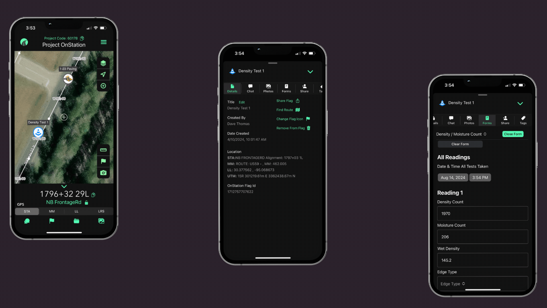
LIVE STATION OFFSET IN THE FIELD
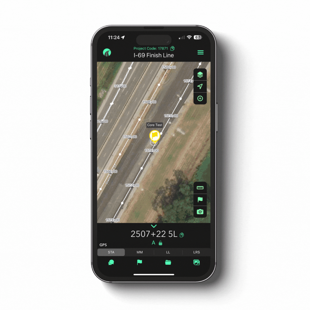
Real-time GPS Stationing: Instantly know your location on the jobsite in reference to station, mile marker, lat/long, LRS.
Document & Capture Field Data: Document work completion, track testing, and flag issues with time, date, and station stamped location from the field.
Data Portal: Export data for use with your PMS, daily diaries, and pay workflow.
As-builts & GIS Integration: Streamline the creation of as-built documents and export GeoJSON files for GIS systems.
Survey123
FORM-BASED FIELD DATA COLLECTION

Document & Capture Field Data: Form-based GIS data collection.
Data Analysis: Ability to analyze survey data to gain insights and create reports.
GIS Integration: Integrates with Esri ArcGIS platform.

Project: New Highway Bypass Construction
A State DOT is building a 10-mile bypass around a city utilizing multiple teams; design engineers, contractors, inspectors, environmental staff, and surveyors.
When to
use both?
Use OnStation:
Field crews view their live station and offset to place drainage pipes, subbase, or pavement.
Inspectors drop flags with photos at exact station locations where compaction fails or note where utilities are exposed.
DOT project managers reference alignment files and design PDFs on-site within the app, no paper plans required.
Maintenance flags are added for future work (shoulder rut at 213+50).
Use Survey123:
Environmental compliance teams walk corridor before clearing, using forms to record:
Wetland boundaries
Invasive species locations
Protect species sighting
Each form submission includes:
photos
GPS location (lat/lon)
Drop-down data like vegetation types or permit IDs
Form data flows into ArcGIS dashboard for reporting
How they
work together
The wetland flags identified in Survey123 get converted to a GIS layer.
That layer is imported into OnStation for the construction team to reference.
For example: “Environmental buffer: No equipment past STA 120+25, 50’ RT”
Later, inspectors use OnStation to document silt fence installation at the flagged station, adding photo confirmation.
Bonus
integration tip
Survey123 collects structured forms into ArcGIS.
OnStation visualizes the GIS data and adds field-based flags with stationing.
Together, They help ensure field compliance, design accuracy, and documentation.

In the Field
Learn how a Project Manager at APEX Engineering used OnStation’s date and station stamped photo documentation to save $80,000.
“If you can prove all these pictures wrong with the exact locations then have at it. And that was the end of the conversation.”
- APEX Engineering Project Manager
STA: 1786+45 14R
=
MM: 461.991
=
LL: 30.380179,-95.067204
=
LRS: 461.458 2L
=
STA: 1786+45 14R = MM: 461.991 = LL: 30.380179,-95.067204 = LRS: 461.458 2L =
From the Field

FREE Stationing Training
Our stationing experts created these training videos to help individuals in the industry learn about the most important aspect of a job… Location!

Stationing is the project locationing system that allows individuals to budget, design, and construct roadway projects. The following lessons will cover the different types of stationing and why they are important.