
OnStation vs. AGTEK
“Not everyone in the field has access to a GPS rover. With OnStation, you can verify your location with your phone.”
OnStation excels in field operations with live station/offset and location-based documentation while AGTEK enhances pre-construction planning and takeoff estimation.
What’s the
main difference?
OnStation
LIVE STATION OFFSET IN THE FIELD

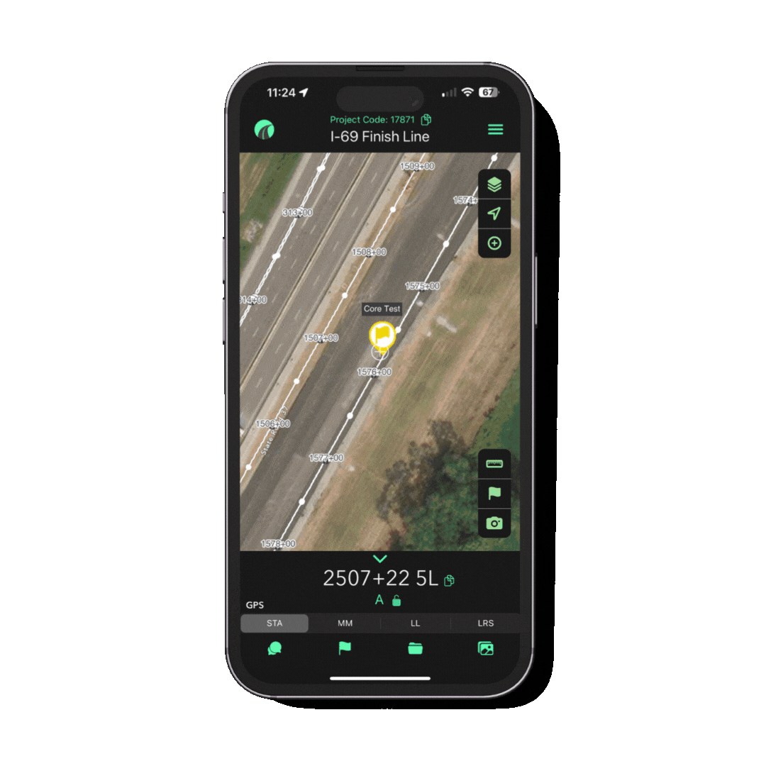
Real-time GPS Stationing: Instantly know your location on the jobsite in reference to station, mile marker, lat/long, LRS.
Document & Capture Field Data: Document work completion, track testing, and flag issues with time, date, and station stamped location from the field.
As-builts & GIS Integration: Streamline the creation of as-built documents and export GeoJSON files for GIS systems.
AGTEK
CONSTRUCTION ESTIMATING & TAKEOFF

Earthwork Estimation & Takeoff: Pre-construction planning tool, provides accurate material quantities and 3D models.
Production Tracking & Modeling: Monitors earthmoving operations and productivity in real-time, for site grading and material management.

Use OnStation with AGTEK to create a powerful field-to-office workflow, combining real-time stationing and documentation with earthwork modeling and production tracking.
Validate takeoff data
in the field using OnStation, ensuring quantities and locations match actual site conditions.
Enhance as-built documentation allowing for more accurate and detailed field documentation.
Improve QA/QC
and project validation, catch discrepancies, flag issues, and confirm quantities.
Create a location based
verified project record
STA: 1786+45 14R
=
MM: 461.991
=
LL: 30.380179,-95.067204
=
LRS: 461.458 2L
=
STA: 1786+45 14R = MM: 461.991 = LL: 30.380179,-95.067204 = LRS: 461.458 2L =
From the Field

FREE Stationing Training
Our stationing experts created these training videos to help individuals in the industry learn about the most important aspect of a job… Location!
Stationing is the project locationing system that allows individuals to budget, design, and construct roadway projects. The following lessons will cover the different types of stationing and why they are important.