
“It allows anyone to install an app on their device, find their project and have stationing access to plans.”
OnStation vs. HCSS Plans
What’s the
main difference?
OnStation provides your live station/offset in the field while HCSS Plans provides extensive plan sheet management.
OnStation
LIVE STATION OFFSET IN THE FIELD
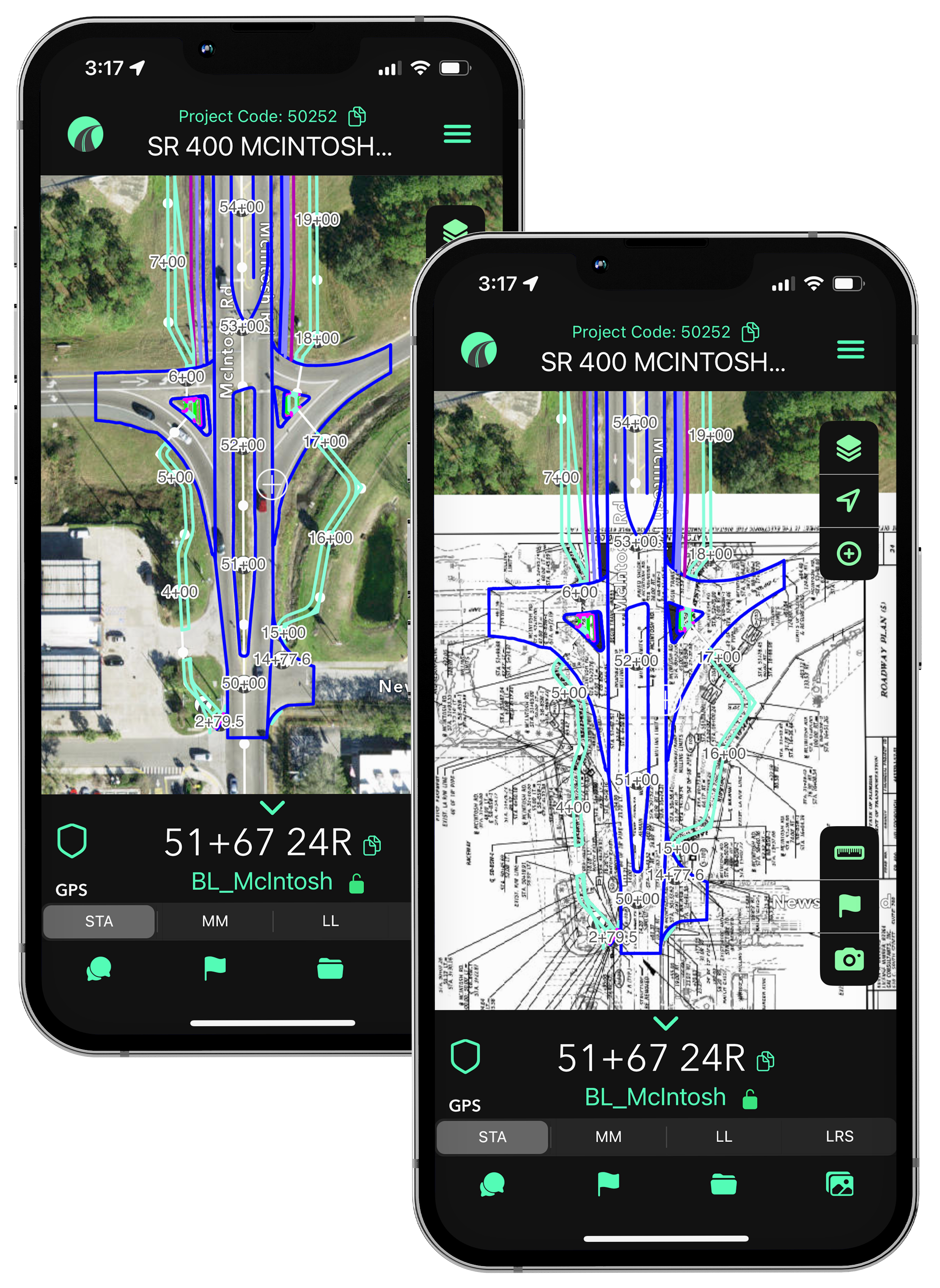
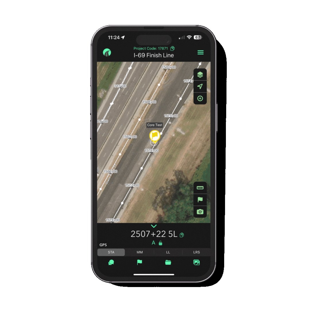
Real-time GPS Stationing: Instantly know your location on the jobsite in reference to station, mile marker, lat/long, LRS.
Document & Capture Field Data: Document work completion, track testing, and flag issues with time, date, and station stamped location from the field.
Project Progress & Validation: Quickly validate work completed for inspectors and DOT with QA/QC flags tied to station.
Integrates with HeavyJob
HCSS Plans
PLAN SHEET MANAGEMENT
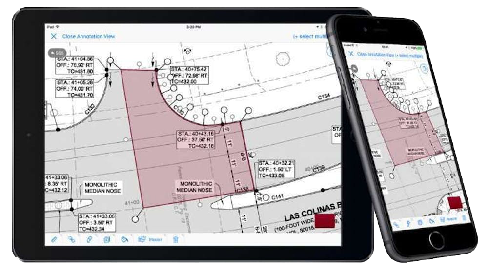
Robust Plan Set Viewing: Load large sets of plan sheets, organize by discipline, and manage versions.
Markup & Communication: Draw, highlight, and comment directly on plan sheets with the ability to share annotated plans between the field and office.
Field Integration: Helps view plans alongside timecards, safety forms, and equipment logs.
Integrates with HeavyJob

Choosing the Right Tool:
OnStation vs. HCSS Plans for Field Documentation & Plan Access

When deciding between OnStation and HCSS Plans—or when to use both—it’s important to consider the specific needs of your project. HCSS Plans is best suited for teams focused on reviewing and marking up full plan sheets, particularly when working from a traditional plan set. In contrast, OnStation excels in field environments where real-time GPS stationing, location-based documentation, and team communication are critical—especially for large-scale civil and DOT work.
For projects that demand both detailed plan access and precise, station-based tracking, using the two tools together can provide a more complete workflow. HCSS Plans allows engineers to stay oriented within complex plan sets, while OnStation connects those plans to real-world locations, enabling field crews, inspectors, and contractors to document work, communicate issues, and track progress directly by station.
STA: 1786+45 14R
=
MM: 461.991
=
LL: 30.380179,-95.067204
=
LRS: 461.458 2L
=
STA: 1786+45 14R = MM: 461.991 = LL: 30.380179,-95.067204 = LRS: 461.458 2L =
From the Field

FREE Stationing Training
Our stationing experts created these training videos to help individuals in the industry learn about the most important aspect of a job… Location!

Stationing is the project locationing system that allows individuals to budget, design, and construct roadway projects. The following lessons will cover the different types of stationing and why they are important.